NavPix™ - GPS Geo-referrenced Photos
 Navman's new service NavPix™
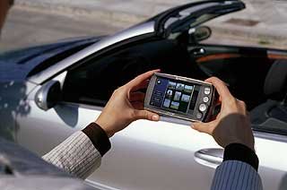
 Take a GPS, add a camera, take a picture, then record the position and voila we have what is known as a geo-referenced photo which can identify exactly where a picture was taken. Navman have very cleverly added functionality to the new iCN7xx hardware and software to allow you to navigate to one of these picture POIs. They have named this new feature NavPix™. So what is the idea behind this? When you find somewhere, maybe by chance, that you want to go back to, or you just think it is such a find that you want to share it, then you take a picture using your iCN7xx. (The new Navman iCN7xx range: iCN720 and the iCN750. ) As long as you have a GPS fix, the latitude and longitude of your location will be embedded into the picture file. This will pinpoint the location that the image was created allowing you or someone who has your picture to navigate to. There will be an area on Navman’s website where you can upload your NavPix to. Similarly, you can download other NavPix which have been uploaded by others. The potential for this is endless. PocketGPSWorld.com is already talking to Navman with a view to creating a database of NavPix™ POIs. You can imagine Realtors creating open-house tour guides where buyers could be directed to the exact viewpoint. Plug these into itineraries and you can have compact city guides.
I'm not sure exactly how this technology will work for appraisers?
- What is the quality of the photo?
- How easy is it to download from the Web back to a PC?
- How would this interface with appraisal software and existing mapping?
For the full story at Pocket GPS World click here.
Appraisalposted by Brian J. Davis at
4/04/2006 07:37:00 AM
![]()
![]()

0 Comments:
Post a Comment
<< Home